

Nestled within the verdant embrace of the Great Smoky Mountains lies a labyrinth of trails, where every bend and rise holds secrets whispered by nature herself. For those who seek to explore these rugged paths, a map and compass aren’t just tools; they are your steadfast companions, guiding you through the intricate dance of terrain and horizon. While modern technology offers the allure of convenience, there’s a profound satisfaction in mastering these age-old navigational skills, connecting with the spirit of explorers who once braved the wilderness armed only with the stars and their trusted instruments. This article unfolds the art and technique of using a compass and map, empowering you to navigate the Smokies’ majestic trails with confidence and respect for the land’s timeless allure. Whether you’re a seasoned adventurer or a curious newcomer, join us as we journey into the heart of one of America’s most beloved natural sanctuaries, led by the magnetic pull of wonder and discovery.
Understanding Your Tools: The Basics of Compass and Map Navigation
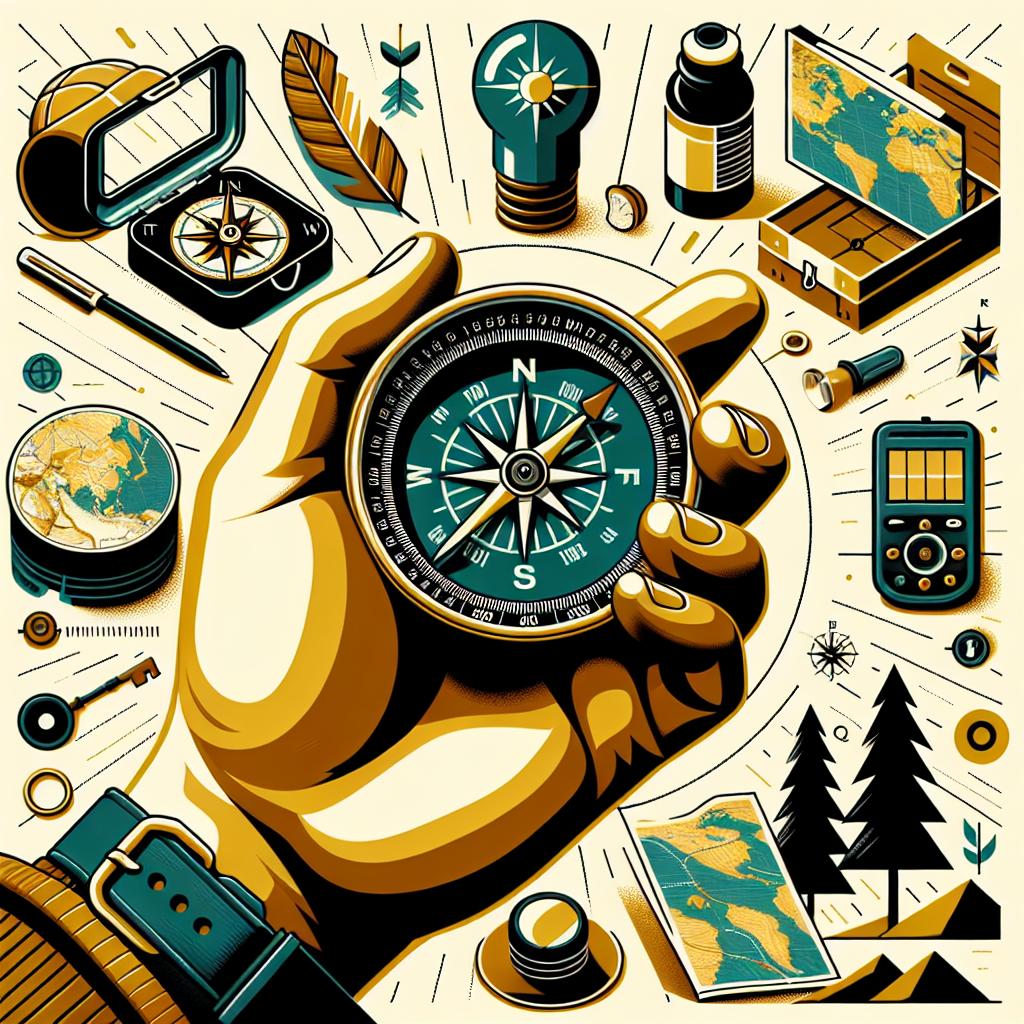
Embarking on a hike through the Smoky Mountains requires a solid understanding of basic navigation skills to ensure a safe and enjoyable adventure. Mastering the art of compass and map usage is your gateway to confidently exploring the wilderness. A compass, with its ability to align with Earth’s magnetic field, acts as your steadfast guide, always pointing towards magnetic north. Key elements of the compass include the baseplate, which is the rectangular platform you hold, the direction-of-travel arrow indicating where to go, and the magnetic needle that swings on its axis. The orienting lines and dial allow you to align your map to the terrain. Using the compass in conjunction with a topographic map, which showcases the landscape’s ridges, valleys, and elevation changes, you can accurately plot directions and identify landmarks, ensuring you never lose your way.
To make the most out of your map and compass, it’s crucial to familiarize yourself with some terms and symbols you’ll encounter. The map legend is your friend, translating symbols into understandable features; for example, blue lines often signify streams, while brown lines indicate elevation. Steps to navigate with a map and compass include:
- Identify your location and mark it on the map.
- Align the map with the terrain using the compass.
- Select your destination, draw a line towards it, and adjust your path as you move.
- Regularly check the compass to ensure you’re maintaining the correct bearing.
With practice, these navigation techniques can become second nature, transforming the sometimes-daunting wilderness of the Smokies into a well-charted adventure playground.
| Map Symbol | Meaning |
|---|---|
| Wavy blue line | River or stream |
| Brown contour lines | Elevation change |
Decoding Terrain: How to Interpret Topographic Maps
Understanding the intricacies of a topographic map is crucial for a successful hiking trip in the picturesque Smoky Mountains. Firstly, familiarize yourself with the contour lines that depict elevation. These lines tell a vivid story of the terrain; closely packed lines indicate steep inclines, while wider spaces suggest gentle slopes or even flat areas. Peak points are typically represented by concentric circles, with the smallest circle marking the summit. Additionally, be mindful of the color coding used throughout the map; green signifies forested areas, tan or white denotes open land, and blue represents water bodies.
Furthermore, learn to decipher the legend and scale often placed in the corners or edges of the map. The legend acts as an indispensable guide, translating symbols into understandable segments—like indicated campsites, trails, and water sources. The scale, meanwhile, provides a metric to gauge real-world distances, essential for planning your route. Here’s a quick reference chart to help visualize the relationship between some common topographic map symbols and their meanings:
| Symbol | Meaning |
|---|---|
| –– | River or Stream |
| ▲ | Forest |
| ___ | Road |
| ○ | Campsite |
By mastering the skills to interpret these maps, you empower yourself for an enriching and safe exploration of the wilderness.
Setting Your Course: Practical Compass Techniques for Hikers
When venturing into the mist-laden trails of the Smoky Mountains, mastering the art of using a compass alongside a map becomes not just a skill but a necessity. Begin by familiarizing yourself with the fundamental parts of a compass: the baseplate, direction-of-travel arrow, magnetic needle, orienting arrow, and rotating bezel. Holding your compass flat, align its edge with your map’s North-South grid lines, ensuring the direction-of-travel arrow points towards your intended destination. Set the bezel to read the required bearing and keep the magnetic needle in line with the orienting arrow as you traverse the trails. Here, the dense foliage of the Smokies often obscures visible landmarks, making this skill indispensable.
To enhance your navigation prowess, incorporate these techniques:
- Triangulation: Use recognizable peaks and geographical features to pinpoint your exact location by taking bearings to these known points and creating a triangle that encloses your position.
- Pacing: Measure your steps to estimate distances traveled when landmarks are few. A trail through Rhododendron thickets might tempt you to wander, but keeping a steady pace secures your course.
- Catch Features: Identify prominent natural features or trail junctions that are ‘hard to miss’ to prevent wandering too far off track.
Always combine these techniques with your compass abilities for reliable navigation.
| Compass Technique | Description |
|---|---|
| Triangulation | Locating position using three bearings. |
| Pacing | Step counting for distance estimation. |
| Catch Features | Key landmarks to maintain course. |

Integrating Skills: Navigating the Smokies with Confidence
Embarking on a hiking journey through the majestic trails of the Smokies requires more than just physical stamina—it’s an art of mastering skills that integrate understanding of both topography and the tools that guide your path. The classic compass and map duo can become your most reliable companion in this adventure. Begin by holding the map and compass together, aligning the compass’s baseplate to the top or bottom of the map so the north on both the map and the compass align. Ensure the map is oriented according to the surrounding terrain, a tip to remember is to locate identifiable landmarks which correspond with points on your map. With practice, this tandem usage unwraps a newfound confidence, transforming the daunting intricate paths into a delightful exploration.
| Guide | Usage | Benefit |
|---|---|---|
| Compass | Orienting direction | Helps avoid getting lost |
| Map | Pathfinding and terrain analysis | Visualizes elevation and distance |
The Smokies present a dynamic landscape where each ridge or valley can potentially obscure typical path markers, amplifying the need for precise skill in discerning your route. Among your essential steps are using a map’s contour lines to estimate elevation changes and paths’ steepness, and tracking your journey by regularly consulting both tools together. Key positional checks throughout your hike ensure you remain on a determined course, instilling confidence as you navigate amid lush forests and breathtaking vistas. Remember, every twist and turn bears not just the promise of wild beauty but the rewards of skillfully connecting nature’s might with human ingenuity, one calculated step at a time.
Q&A
Q: Why is it important to know how to use a compass and map when hiking in the Smokies?
A: While the Smokies offer breathtaking landscapes and well-trodden paths, technology isn’t always reliable in the deep wilderness. Knowing how to use a compass and map ensures that you can navigate effectively, even when GPS signals falter or batteries fail. Understanding these traditional navigation tools helps keep you on the right path, secures your safety, and enhances your experience as you explore this stunning natural wonder.
Q: What are the basic components of a compass that hikers should be familiar with?
A: A compass typically consists of a magnetic needle that points toward magnetic north, a baseplate with a ruler for measuring distances on a map, and a rotating bezel or housing with degree markings. Some compasses also include additional features like a magnifying lens, orienting lines, and a direction-of-travel arrow. Familiarity with these components can help hikers accurately orient themselves and their maps.
Q: How do I align my map with the compass to determine my direction?
A: To align your map with the compass, first lay the map flat. Place the compass on the map and rotate the map until the north on the map aligns with the north arrow on the compass. Make sure the magnetic north indicated by the compass needle matches the grid north on the map. If you’re in an area with magnetic declination, remember to adjust your compass accordingly to ensure accuracy.
Q: What is magnetic declination and how does it affect navigation in the Smokies?
A: Magnetic declination refers to the difference between magnetic north (indicated by your compass) and true north (geographic north) due to variations in the Earth’s magnetic field. In the Smokies, declination can affect navigation, so it’s crucial to adjust your compass settings to account for any discrepancies. Check current declination values for the region and apply necessary corrections to ensure precise navigation.
Q: Can you explain how to take a bearing on a landmark using a compass?
A: To take a bearing on a landmark, hold the compass flat at waist level, ensuring the direction-of-travel arrow points at the landmark. Look directly at the landmark and rotate the bezel until the magnetic needle aligns with the orienting arrow inside the compass housing. The degree marking at the index line (the black line inside the bezel) is your bearing. Recording this bearing helps you maintain your intended direction as you navigate.
Q: How can topographic maps enhance hiking navigation in the Smokies?
A: Topographic maps provide a detailed representation of the terrain, including elevation changes, rivers, trails, and landmarks. By understanding contour lines and symbols, hikers can gain insights into the landscape, anticipate challenging sections, and choose routes that match their skill level. When combined with compass navigation, topographic maps are invaluable in planning safe and enjoyable hikes in the Smokies.
Q: What are some common mistakes to avoid when using a compass and map on the trail?
A: Common mistakes include neglecting to account for magnetic declination, failing to periodically check your direction, and not practicing before hitting the trail. Additionally, relying solely on technology or the assumption that well-marked trails don’t require navigation skills can lead to trouble. It’s essential to regularly practice navigating with a compass and map to develop competence and confidence.
Q: Are there any tips for beginners learning to use a compass and map in the Smokies?
A: Beginners should start by familiarizing themselves with the basic parts and functions of the compass and try practicing in an open area with minimal obstacles. Joining a guided hike or taking a navigation course can provide valuable, hands-on learning experience. Always start with easy trails before progressing to more challenging ones. Remember, practice makes perfect; the more you use your compass and map, the more proficient you’ll become.
Future Outlook
As you lace up your boots and prepare to embark on your next adventure in the enchanting embrace of the Smokies, remember that your journey is not just about reaching a destination, but about savoring the path itself. With a trusty compass in one hand and a well-detailed map in the other, you’ve unlocked the art of navigation that transforms every trail into a tale of discovery. The Smokies, with their whispering winds and timeworn trails, become your personal canvas where adventure is yours to paint.
Let each step resonate with confidence and curiosity, as you traverse landscapes that have inspired wanderers for centuries. As the sun casts golden hues over towering peaks and hidden valleys, trust in your newfound skills to guide you. Whether tracking the subtle curve of a contour line or aligning your compass to the true north, you’ve become a part of a timeless tradition, connecting with nature in its most authentic form.
So, as you chart your own course through the Smokies, know that you carry with you the spirit of exploration. May your adventures be safe, your discoveries plentiful, and your heart ever open to the wild wonders that await. Here’s to embracing the unknown and cherishing the journey—one compass bearing at a time.